← Back to the collection

Make / Selected work / 01

3D Scanner

An iPhone app for capturing objects and spaces, editing the result and keeping the files under your control.

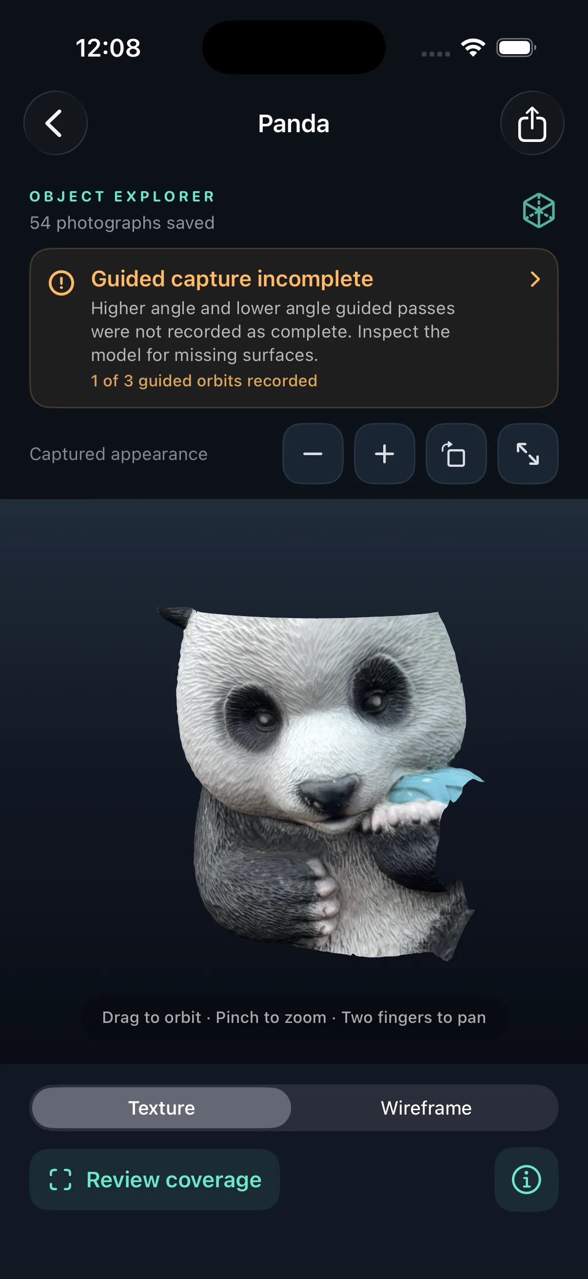
The 3D Scanner Object Explorer showing a textured reconstruction of a small panda figure and a warning about incomplete capture coverage.View full size ↗
In the project

A real early iPhone capture of the Panda reconstructed from 54 photographs. The missing surfaces are left visible, and the app flags that only one of three guided passes was completed.

About this image

Physical iPhone capture reviewed in the app · 10 September 2026
Revision: ScannerPOC 0.5 (6) · ca78ebb43fcc · scan 1720577B

My role
Product design and iOS development across capture, editing and export.
Key decision
Processing stays on the phone. Edits create separate versions, preserving the original scan.
Evidence
Physical object scans, reconstructed models, actual exports and clearly labelled simulator screenshots.
Source
The source code is private. The iPhone app is in development, with no public download.

Scan it. Shape it. Keep it.

The starting point

A scan is only useful when you can see where it is incomplete, return to it later and move the result into the tools you already use.

What I built

3D Scanner brings several practical capture paths into one local app. Guided object capture builds textured models, while LiDAR modes cover rooms, connected floor plans, outdoor routes and larger surfaces on supported iPhones. Room and level exports preserve observed wall, door, window and opening spans as dimensioned plans; they do not infer wall thickness, door swings, floor area or unseen structure.

For building fronts and other exterior elevations, architecture experiments turn observed walls, windows, doors and openings into editable drawings. A separate site-mapping mode keeps the walked camera route beside observed surface coverage instead of pretending it has recognised every path or boundary.

A climbing workspace explores another use for the same geometry: keep a wall shape, sketch routes and volumes, and attach test-climb notes. The published example is synthetic practice geometry; real gym capture and setter-led acceptance are still in progress.

Saved work can be reopened rather than disappearing into a one-shot capture. The Edit Lab keeps the original scan and creates separate cropped or processed versions, so an incomplete edge or unwanted surroundings remain visible decisions instead of hidden cleanup.

Models can leave the app as USDZ, STL, OBJ, GLB or PLY. Room workflows also produce portable plans and data such as SVG, DXF, PDF, CSV and JSON. Processing is local; sharing starts only when you choose it.
The current app

More than one kind of scan.

The gallery shows a few examples. The current development build also includes these implemented workflows; experimental and hardware-dependent areas are marked plainly.

01Capture · local

Objects & textured surfaces

Guided multi-pass object capture and a photograph-based surface mode build textured models locally. Review texture, wireframe, six-side coverage, approximate bounds and capture history before exporting.

02LiDAR · supported iPhones

Quick LiDAR & wall shapes

Sweep without photographs, rotate and resize the area to keep, save separate crops, remove fragments or smooth a copy. Wall mode fits broad panels while retaining the observed mesh for comparison.

03RoomPlan · experimental joining

Rooms & whole buildings

Scan a room into a dimensioned plan and 3D explorer, keeping walls, doors, windows, openings and object boxes distinct. Correct missed features, join rooms into levels, review observed stair regions and build a combined 3D structure.

04Drawings · experimental

Maps, elevations & flat templates

Keep a walked site route beside observed coverage, then draw and edit paths, beds, boundaries and buildings. Create facade elevations, or derive a checked outline and holes from a photograph or LiDAR depth for SVG, DXF or optional STL.

05Editing · saved versions

Edit Lab & scan to print

Open a saved scan or import STL, OBJ or ASCII triangle PLY with explicit units. Crop, process and inspect separate versions, export the captured shape or make a solid-backed relief without overwriting the source.

06Experimental · on device

Gaussian scenes

Capture or import Gaussian splats, train and explore them on the phone, then crop or filter opacity and oversized splats. Cleanup versions export as Gaussian PLY; a scene and its original capture can leave as a ZIP.

07Experimental

Climbing workspaces

Keep wall shapes, photographs, measured references, route and spray-wall sketches, holds, volumes and test-climb notes together. Preview layouts in 3D, try the re-aligned AR overlay and export the workspace.

08Raw evidence · recovery

Capture Coach & recovery

Raw photo and LiDAR sessions add frame-quality checks, coverage prompts, rough previews and shareable capture ZIPs. Saved libraries keep originals and unfinished inputs visible, with retry paths where usable source data remains.

These paths do not all have the same maturity. LiDAR, RoomPlan and Area modes depend on supported hardware and OS versions. Outdoor mapping, building joining, Gaussian and climbing work remain experimental; a raw capture is not a finished model, splats are not printable meshes, maps are not survey-grade and no export is a promise of printability. Models use USDZ, STL, OBJ, GLB or PLY; plan workflows add SVG, DXF, PDF, CSV and JSON.

Closer to the work

Interfaces & outputs
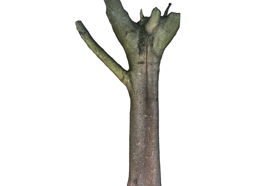
A textured 3D reconstruction of a forked tree trunk isolated against a transparent background.View full size ↗
From the tool

A textured tree-trunk model processed locally from a physical iPhone object scan. This is the phone's reconstructed model rendered for the page, not a photograph of the surroundings.

About this image

Physical iPhone scan model rendered locally with Apple USD tools · Captured 13 September 2026; rendered 19 September 2026
Revision: ScannerPOC scan 6EEA50BB · model 4a5aa9665ccd

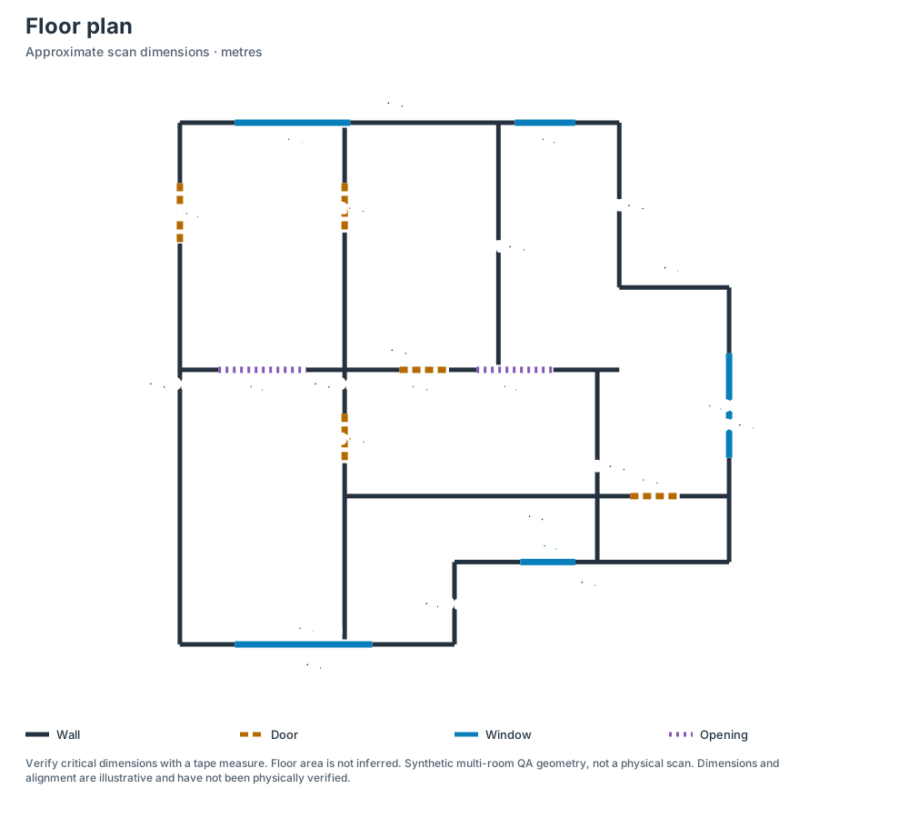
A synthetic multi-room floor plan exported by 3D Scanner with an irregular outline, internal walls, doors, windows, openings and metric dimensions.View full size ↗
From the tool

An actual SVG floor-plan export from a privacy-safe synthetic level: 13 wall spans, five doors, five windows and two openings, all kept separate and dimensioned. It shows the scan-derived map the app can produce without publishing a real home layout. The exporter does not infer wall thickness, door swings, stairs, room areas or unseen structure.

About this image

Actual app floor-plan export from deliberately synthetic geometry · Generated 20 September 2026
Revision: ScannerPOC 0.19.1 source · FloorPlanDocument.write(to:) · 715a83977cb

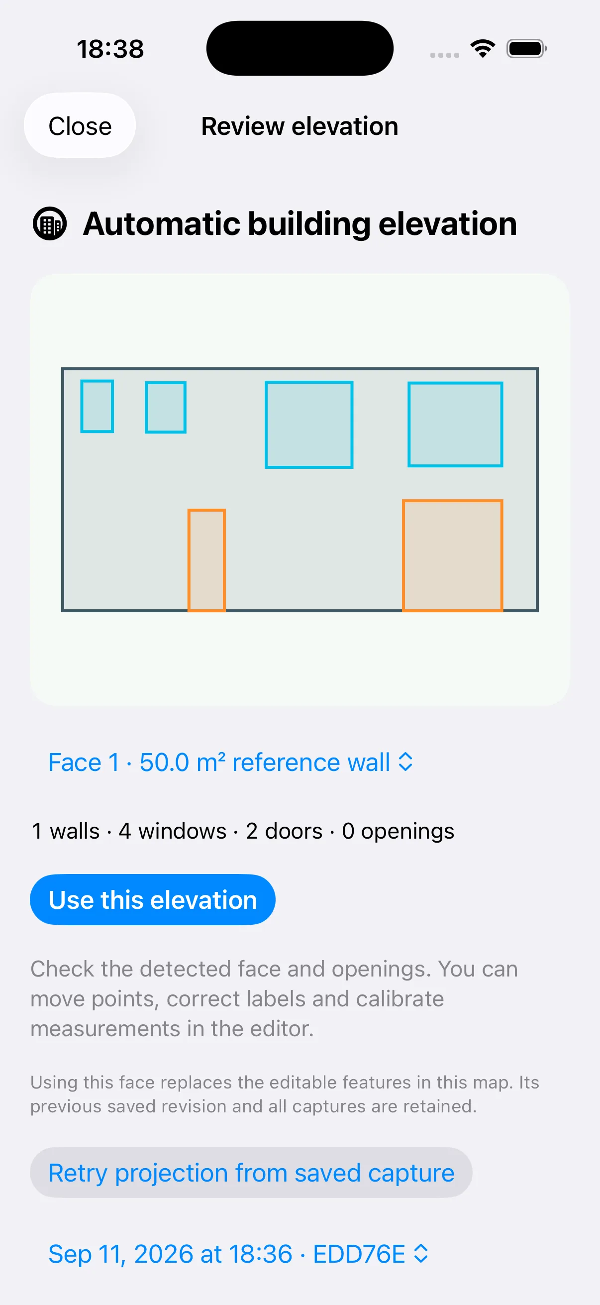
The 3D Scanner building-elevation review showing one wall, four windows and two doors as an editable flat projection.View full size ↗
In the project

The elevation workflow reviews walls, windows, doors and openings before adopting them into an editable drawing. This Simulator view replays real saved exterior observations: one wall, four windows and two doors. Outdoor detection can still miss or misclassify features, so this is not a complete facade or survey claim.

About this image

Real saved exterior capture replayed in iOS Simulator; no house photograph or address shown · 11 September 2026
Revision: ScannerPOC 0.9.1 (12) · 699d82cb07ad

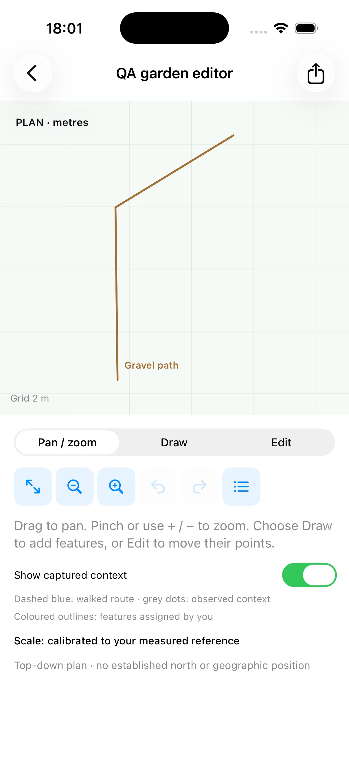
The 3D Scanner site-map editor showing a synthetic gravel path as an editable line drawing on a metre grid.View full size ↗
In the project

A Simulator QA fixture manually draws a synthetic gravel path, edits its points and persists calibration against a 10 m test reference. The production capture mode can retain the walked camera route and LiDAR context, but this public image is synthetic: it does not demonstrate automatic capture, real-world accuracy, path-edge recognition, GPS or survey-grade coordinates.

About this image

iOS Simulator path-editing fixture with deliberately synthetic geometry; no property layout shown · 11 September 2026
Revision: ScannerPOC 0.9 (11) · d0fec58e1b47

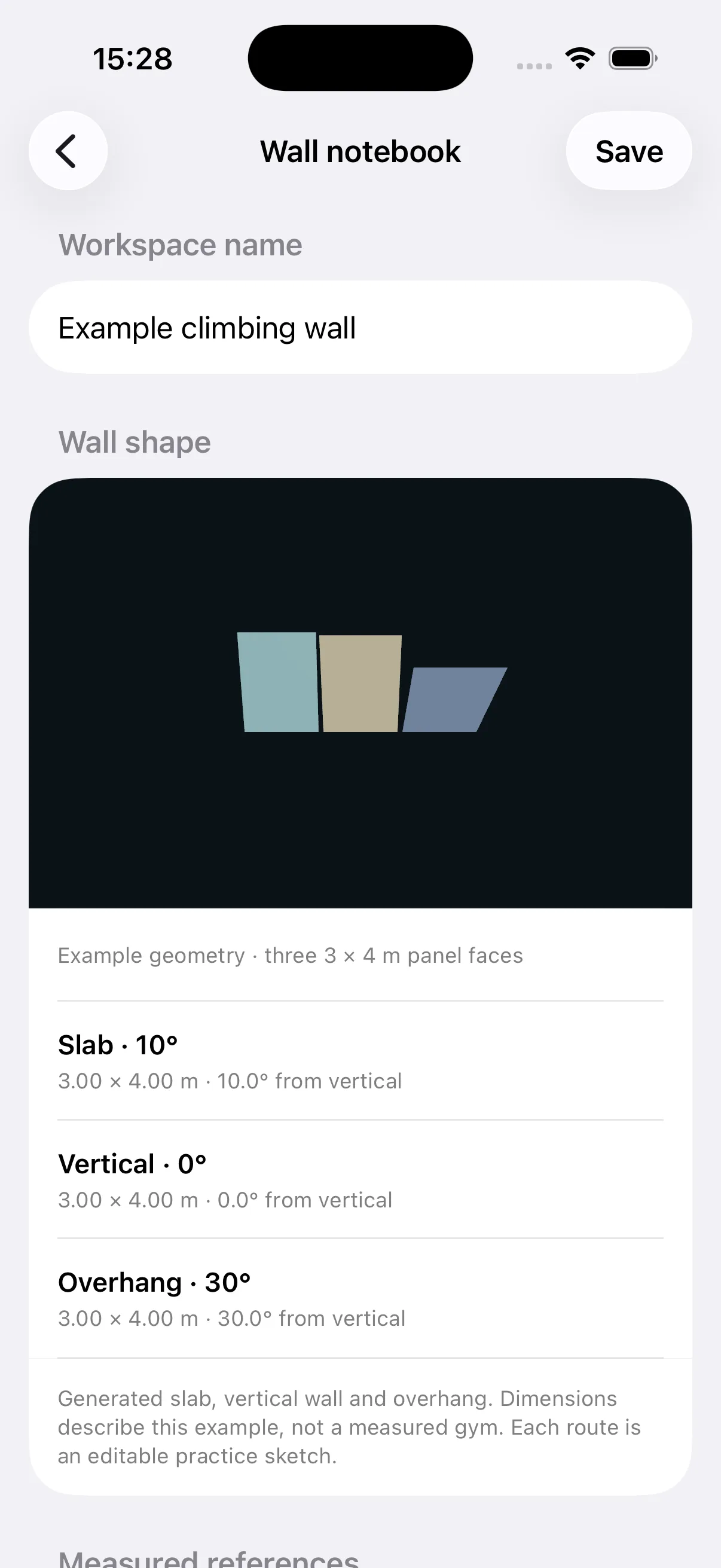
The 3D Scanner climbing wall notebook showing synthetic slab, vertical and overhang panels with their dimensions and angles.View full size ↗
In the project

The climbing experiments keep wall shapes, route sketches, volumes and test-climb notes in a local workspace. This three-panel example is synthetic practice geometry, not a scanned gym or a physically tested route; real wall capture and setter-led acceptance remain open.

About this image

iOS Simulator climbing-workspace example with deliberately synthetic geometry · 15 September 2026
Revision: ScannerPOC 0.19.1 (28) · 61ac496ed5ba

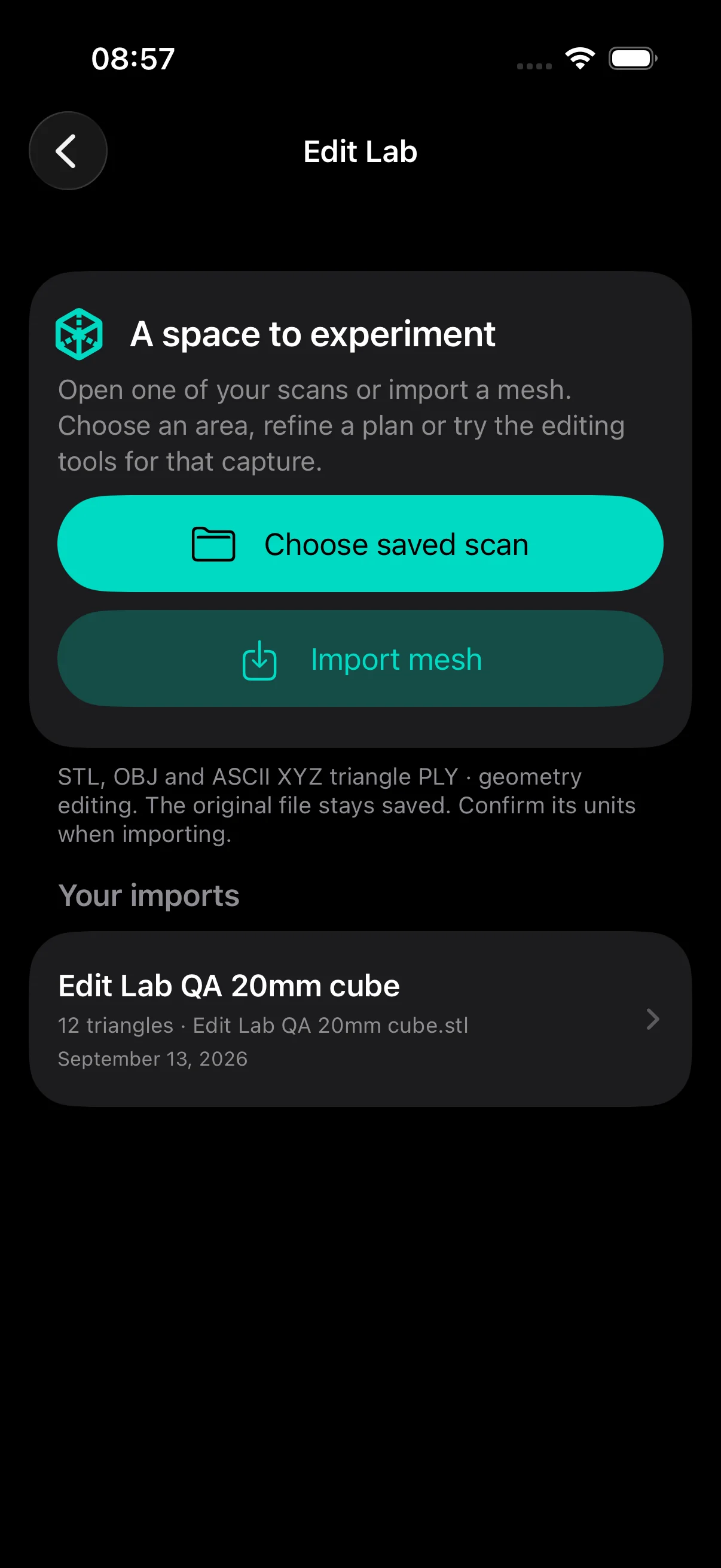
The 3D Scanner Edit Lab start screen offering a saved scan picker and mesh import beside a synthetic 20 millimetre cube fixture.View full size ↗
In the project

Edit Lab opens saved scans or imports STL, OBJ and ASCII triangle PLY with explicit units while keeping the source intact. This Simulator view uses a synthetic 20 mm cube to prove the workflow without publishing private scan geometry.

About this image

iOS Simulator Edit Lab fixture with a deliberately synthetic 20 mm cube · 13 September 2026
Revision: ScannerPOC 0.18.1 (26) · c310a5fb83d3

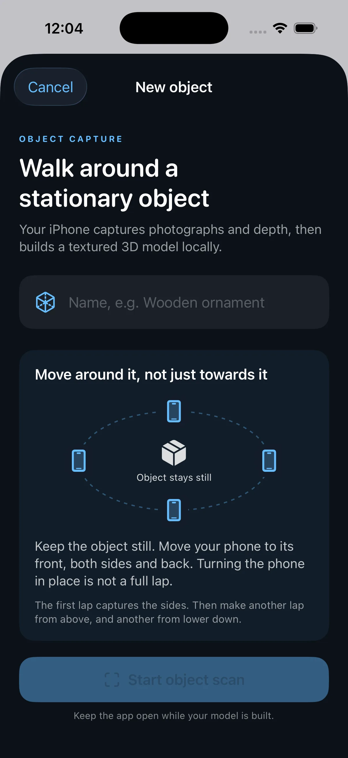
The New object screen explains three passes around a stationary object before local model building begins.View full size ↗
In the project

Capture guidance asks the person to move around the object, including higher and lower passes, instead of spinning it in place. This simulator screen demonstrates the workflow, not capture quality.

About this image

Retained iOS Simulator product capture · 10 September 2026
Revision: ScannerPOC 0.5 (6) · ca78ebb43fcc